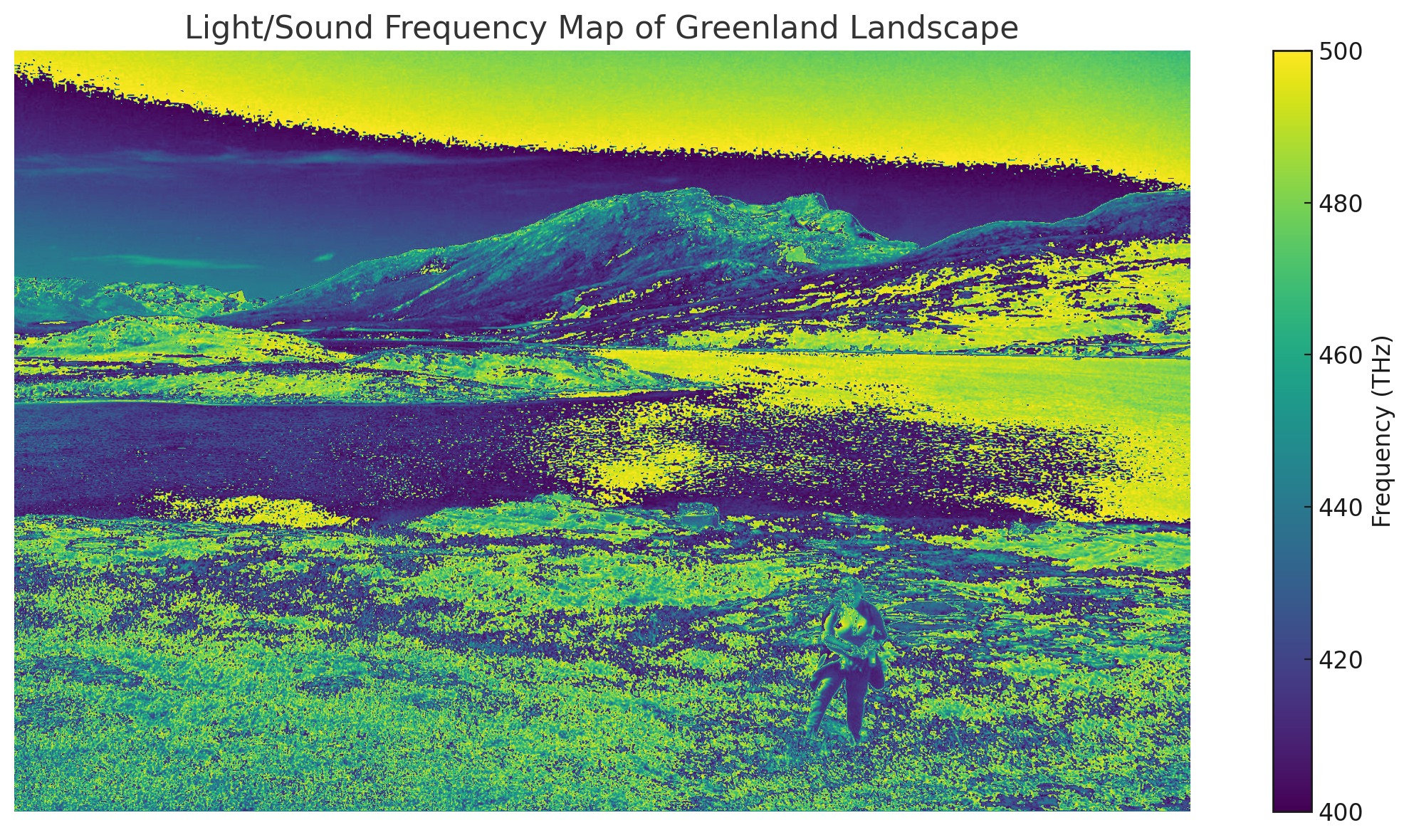
This Greenland landscape, when translated into a light and sound frequency map, offers a new way of perceiving the world — not as a static scene, but as a living field of vibration. Each pixel of the image is reinterpreted through the visible light spectrum, ranging from approximately 400 to 700 terahertz (THz), revealing zones of high resonance where light reflects strongly, and areas of lower frequency where energy is absorbed or held in rest. Unlike a traditional photograph that captures what we expect to see, this mapping reveals what is actually present in the field — a harmonic structure shaped by wave interactions and environmental coherence. Through the lens of the LSF (Light–Sound–Form) Framework, the landscape becomes a dynamic blueprint of emergence, where form, light, and frequency converge to tell a deeper story of place and presence.
🧭 What You’re Seeing:
- Mapped Frequencies range from 400 THz (deep purple) to 700 THz (vivid yellow) — the full span of the visible light spectrum.
- Bright yellow and green areas reflect higher-frequency zones, such as the sunlit water, sky, and exposed snow— suggesting regions of strong light reflection and energetic activity.
- Dark purples and blues represent lower frequencies, concentrated in shadowed terrain, rocks, and deep ground textures — zones of absorption, rest, or latent energy.
🌌 LSF Interpretation:
Through the LSF (Light–Sound–Form) lens, this landscape becomes a living frequency map, where the terrain is not static but actively resonating. The mountains act as amplifiers, the water as a reflective field, and the foreground vegetation as an interference texture encoding environmental rhythms. This map transforms the photograph into an emergent diagram — a harmonic snapshot of how the land holds and distributes energy across form and frequency.
Leave a Reply